Hurricane Season is heating up once again.
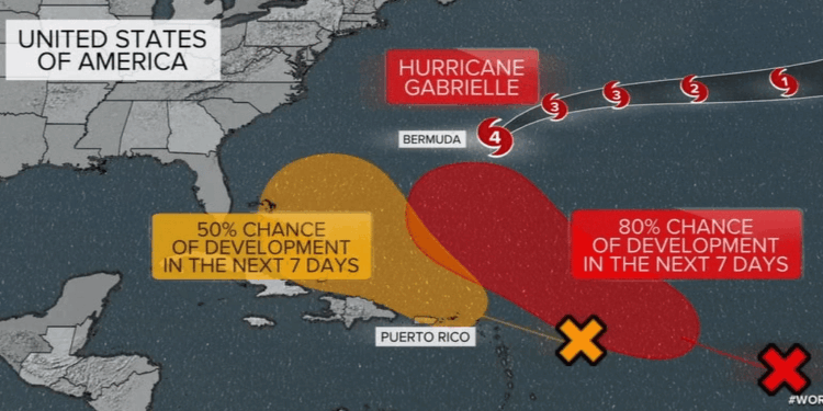
The Atlantic Ocean just flipped the switch. Hurricane Gabrielle has strengthened into a powerful Category 3 storm with winds reaching 125 mph, spinning roughly 600 miles east of Bermuda. Although the island is avoiding a direct hit, Gabrielle is kicking up dangerous surf and rip currents that will ripple along the East Coast from North Carolina to New England through midweek.
While Gabrielle commands attention, two other tropical disturbances are gaining strength in the central Atlantic. The first, farther east, could become a tropical depression or named storm as early as Thursday. Ocean temperatures and atmospheric conditions are ripe for development.
The second disturbance, now approaching the Leeward Islands and moving toward the Bahamas, is less organized but still a contender. It’s already delivering heavy rain and wind to Puerto Rico, where up to six inches of rain could fall by Thursday. That’s raising concerns for flash flooding and landslides, especially in saturated areas.
Forecast models suggest one storm may curve harmlessly into the Atlantic, but the system near the Bahamas is a wild card. If it holds together, it could impact the southeastern United States.
Gabrielle marks the second major hurricane of the 2025 season, following Hurricane Erin. Both rapidly intensified, fueled by unusually warm ocean waters, a pattern scientists say is becoming more common.
With September typically being peak hurricane season, don’t count this one out just yet.


